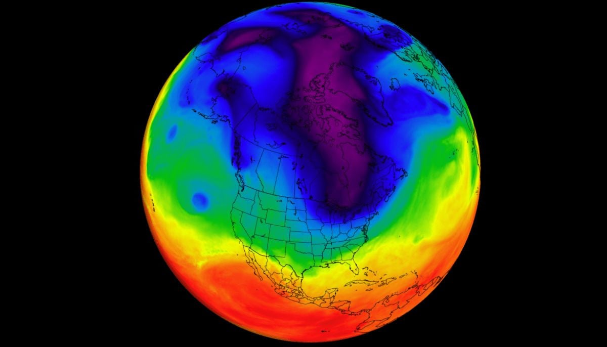
A rare expansion of the Polar Vortex core is currently disrupting the seasonal transition in the Northern Hemisphere. As April begins, the stratospheric Polar Vortex is entering its final seasonal phase. The high-altitude circulation spreads, releasing the lower-level Polar Vortex core and bringing another round of weather impacts across North America and Europe in April 2026.
A fragmented piece of the Polar Vortex remains active in the lower atmosphere and is currently anchored over North America and eastern Canada. This remaining core is responsible for directing Arctic air southward, keeping temperatures below normal and creating a high risk of late-season snowfall in the United States. The weather pattern is determined by the final downward waves of a massive stratospheric collapse that began earlier this year. As the season attempts to pass, the atmosphere undergoes a reset with the traditional winter circulation breaking down in favor of spring dynamics.
The mechanics of the Polar Vertex
The Polar Vortex is a huge, circular weather system that acts like a wall, trapping frigid Arctic air above the poles. It includes two layers: the stratosphere (high altitude) and the troposphere (lower ground level). The system is driven by the extreme temperature difference between the cold Arctic and the warm tropics. When the sun returns to the North Pole in the spring, this temperature difference eventually decreases, causing the engine to fail and the vortex to dissolve.
Current regional impacts
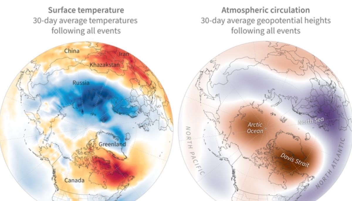
A persistent vortex core over eastern Canada is moving northward. A persistent vortex core from eastern Canada is drawing northern Arctic air into the northern and eastern United States, resulting in below-normal temperatures in early April. While the north remains cold, a warmer westerly and southerly flow spreads simultaneously across the central and southern parts of the United States, creating a sharp temperature contrast across the country.
Most of mainland Europe will see a cooler trend due to a low-pressure pattern pulling in northern air, although the far northern and eastern regions may experience brief warm southerly flows. The forecast model suggests a major transition to a blocking pattern in late April. This represents the final phase of resetting the atmosphere for the remainder of the spring. Experts note that while specific daily temperatures are difficult to pin down before the end of April, broad pressure trends indicate that the atmospheric transition will remain active and somewhat unpredictable through the end of the month.