
El Nino isn’t going anywhere; in fact, it is turning into a ‘super El Nino’ threat that is likely to intensify by the summer of 2026.
The latest forecast from the European Center for Medium-Range Weather Forecasts (ECMWF) suggests that water levels in the equatorial Pacific could reach 2.5 degrees Celsius above normal, highlighting the increasing chances of a super-El Nino.
What is Super El Nino?
A super El Nino is an exceptionally strong version of the El Nino Southern Oscillation (ENSO) cycle, defined by the increased intensity and magnitude of its global disruption.
The main features of El Nino include:
When El Nino becomes extreme, sea surface temperatures rise at least 2.0 C to 2.5 C above the long-term average.
We may also witness atmospheric coupling, which shows a strong shift in ocean heat, completely reorganizing global wind patterns, especially the reversal of the trade winds.
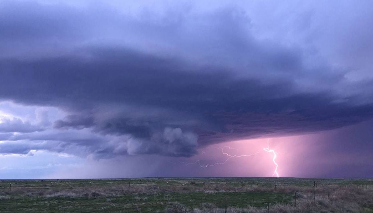
Rapidly fluctuating ocean temperatures can cause a domino effect on global weather systems, including the arrival of severe storms, increased rainfall and massive disruption to hurricane activity.
El Nino occurs when the usual winds weaken or start blowing in the opposite direction. As a result, the eastern Pacific becomes much warmer than normal, leading to heavier rainfall in the Americas and droughts in Australia and Indonesia.
What does super El Nino mean for US states?
With the possible arrival of super El Nino, Metro Detroit and the Midwest will experience intensely drier weather conditions and warmer temperatures. However, the most tangible consequences will be visible during the winter months.
During an El Nino phase, the Pacific Jet Stream strengthens and shifts southward across the US. This shift is causing more storms across the southern states, providing relief to drought-stricken areas and replenishing water reserves ahead of the growing season.
In the wake of super El Nino, the above-mentioned pattern with minimal fluctuations will become more apparent.
For Florida, the super El Nino will bring winter months that are noticeably wetter, stormier and prone to severe weather disruptions.
The Tennessee Valley is often in the middle of two patterns: drier and warmer and wetter and cooler. In general, the further north one is in the region, the greater the chance of drier conditions.
Current forecasts suggest that once this El Nino cycle takes hold, it will last until at least the end of 2026, with the greatest impacts being felt during the winter months.
Rise in global temperatures
According to the predictions of some meteorologists and climate scientists, El Nino could cause an unprecedented increase in global temperatures.
Carlo Buontempo, director of the European Union’s Copernicus Climate Change Service, said: “2026 could be another record year if El Nino appears this year.”
According to Jennifer Francis of the Woodwell Climate Research Center, “If El Niño develops, we will likely set a new global temperature record.”
Impact on the hurricane season
The upcoming El Nino phase could also affect the Atlantic hurricane season by reducing the frequency and intensity of storms.
This phase will strengthen winds and wind shear over the Gulf of Mexico and the tropical Atlantic Ocean, which is responsible for hindering storm development.